Researchers at the Universtiy of Hawaii, Manoa integrated known patterns of fishing with fish survey data to create “seascape models” that reveal areas where the potential for reef fisheries recovery is greatest for each of the eight islands in the archipelago. The seascape models could be of great use to those who have a stake in maintaining the productivity and sustainability of Hawaii’s fisheries, which yield more than 2 million pounds of fish per year.
Creating seascape maps and models
Coral reefs provide critical habitat and serve as breeding grounds and creches for a great diversity of fish and other types of marine life. Reefs and residents are under increasing pressure and threatened directly and indirectly by a host of human activities, however; including warming of ocean waters and ocean acidification due to increasing amounts of carbon dioxide in the atmosphere and ocean waters.
The pressures and threats aren’t limited to Hawaii. “Unsustainable fishing has depleted coastal fisheries worldwide, threatening food security and cultural identity for many coastal and island communities, including in Hawaii,” the university researchers point out.
Combining known patterns of fishing with coral reef biological surveys to create “seascape models,” the researchers created maps that identify key habitats supporting an abundance of coastal fish populations. Creating computer models, they then simulated the effects of removing fishing pressure on these key, critical areas of habitat.
“These detailed maps reveal areas with the highest recovery potential for reef fisheries on each island, providing important information for resources managers,” the university highlights in a news release.
Fish stocks were predicted to increase more than 500 percent on average for identified, key areas of habitat off O’ahu, where over-fishing along the island chain is greatest, according to the results of the simulations.
Across the island chain, the areas where reef fisheries recovery potential is greatest, according to the researchers, are:
- Off the east coast of Kaua’i,
- Southeast and southwest of O’ahu,
- South and northwest of Moloka’i,
- Ma’alaea Bay on Maui’s western shore,
- West Hawai’i Island north of Makole’a point, and
- East Hawai’i Island around Cape Kumukahi and north of Kaloli point
“The results provide hope in terms of the scale of potential recovery in the areas we identified,” said study lead authors Kostantinos Stamoulis, who was a UH Manoa researcher at the time the study was carried out, and Jade Delevaux, geospatial analyst at the UH Manoa School of Ocean and Earth Science and Technology (SOEST).
Reviving reef fish population growth, sustainability
 Full fisheries recovery could take decades the research team noted. Nonetheless, using the “seascape maps” and knowledge gained from the study could prove of great value if used as the basis for a well designed and effectively implemented resource plan.
Moreover, easing or removing fishing pressure on these areas would likely result in more larvae, juvenile and adult fish, which could then replenish over-fished areas, the researchers pointed out.
“Our study also identified remote areas with habitats that currently support healthy fish stocks, such as the north shore of Moloka’i and the south shore of Maui. Managing these areas would ensure that they continue to supplement coastal fisheries into the future,” said the lead authors.
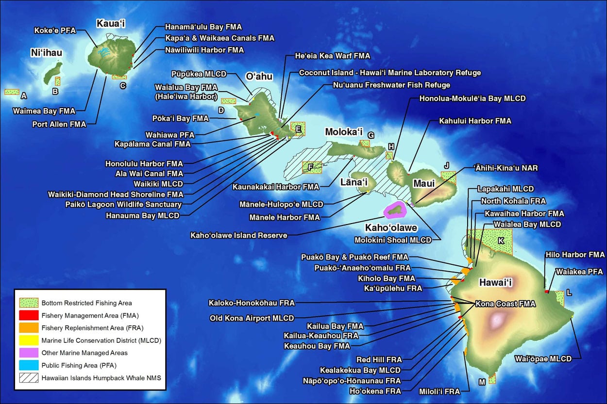
The State of Hawai’i has set a goal effectively managing 30 percent of its nearshore waters by 2030. The State Division of Aquatic Resources is leading a statewide analysis of existing science in partnership with The Nature Conservancy to identify areas for effective marine management to realize that.
“This new study will help us identify those areas with the greatest potential for increasing reef fish populations on all islands,” said Bruce Anderson, Administrator for the Department of Land and Natural Resources Division of Aquatic Resources.
The scientific information gained will be compared with an ongoing spatial analysis as part of Hawaii’s Marine 30×30 Initiative. “Ultimately our intention is to combine this information with local knowledge and collaboratively identify what to do in management focus areas,” Anderson explained.
“To ensure food security and overall ecosystem sustainability into the future, we must significantly increase the amount of area protected from overfishing and other human impacts,” concluded Alan Friedlander, chief scientist for National Geographic’s Pristine Seas program and a co-author of the paper.
“Our study provides an ecosystem-based approach that helps to identify areas that will benefit the most from increased management in Hawai’i and elsewhere.”
*Images credit: 1, 3) NOAA; 2) Hawaii Division of Aquatic Resources
